Application Description
OfflineMaps provides you with access to a comprehensive collection of maps, ensuring you can navigate with ease and confidence, wherever you are.
No advertisements ~ No data sharing & monetization ~ No analytics ~ No third party libraries
Tired of waiting for maps to load? With All-In-One OfflineMaps, once a map is displayed, it's stored and remains accessible quickly, even without an internet connection.
• Looking for more than just roads on your maps? You'll find everything you need right here;
• Do you often venture into areas with poor network coverage? No worries, your maps will stay available;
• Traveling abroad? You'll never feel lost again;
• Concerned about your data allowance? OfflineMaps will help reduce your data usage.
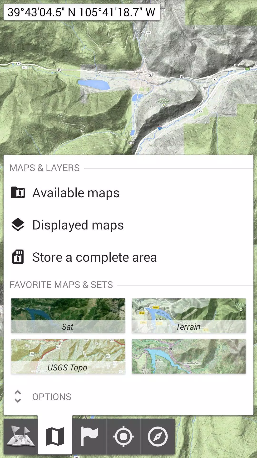
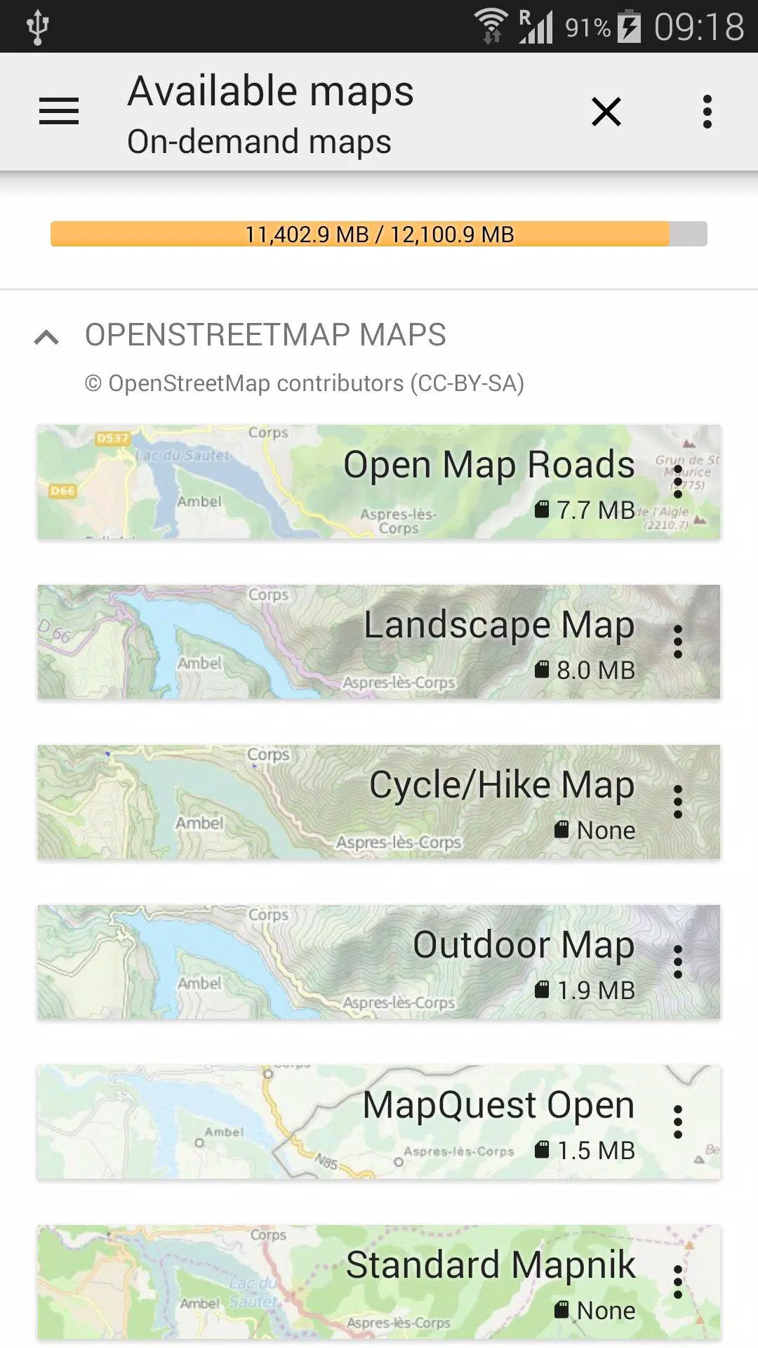
★★ Maps ★★
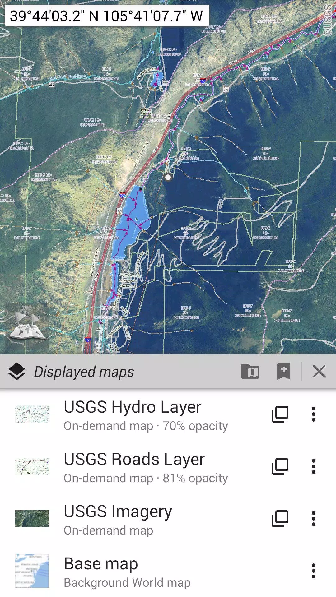
Explore a variety of maps, from classic road maps to topographic maps, aerial (satellite) views, and numerous additional layers you can overlay on any map: OpenStreetMap (Roads, Topo), USGS National Map (High-resolution topo, Aerial imagery), Worldwide Military Soviet topo maps, and more.
• Layer multiple maps with precise opacity control;
• Easily select and store large areas with just a few clicks;
• Manage stored space effortlessly, with the option to delete as needed.
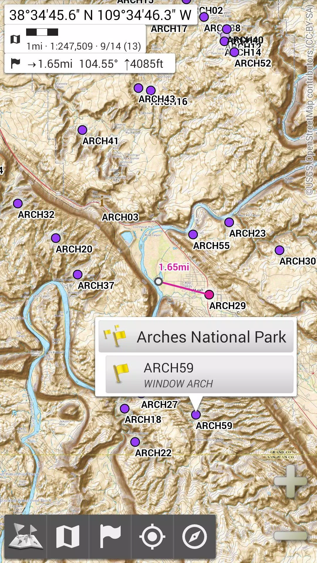
★★ Display, Store, and Retrieve Unlimited Placemarks ★★
Enhance your maps by adding various items like waypoints, icons, routes, areas, and tracks.
Effortlessly manage these with the powerful SD-Card Placemarks Explorer.
★★ On-Map GPS Location & Orientation ★★
Your real-time location and direction are clearly displayed on the map, which can be rotated to align with your actual orientation (depending on your device's capabilities).
Easily toggle on/off to conserve battery life.
Plus:
• Choose between metric, imperial, and hybrid distance units;
• Use GPS Latitude/Longitude and various grid coordinate formats (UTM, MGRS, USNG, OSGB Grid, Irish Grid, Swiss Grid, Lambert Grids, DFCI Grid, QTH Maidenhead Locator System, and more);
• Import hundreds of coordinate formats from https://www.spatialreference.org;
• View on-map grids;
• Enjoy a full-screen map view;
• Utilize multi-touch zoom;
• And more...
★★ Need More? ★★
For avid adventurers, consider AlpineQuest Off-Road Explorer, the ultimate outdoor solution built on All-In-One OfflineMaps, featuring a robust GPS Track Recorder and more: https://www.alpinequest.net/google-play
Screenshot
Reviews
Apps like All-In-One Offline Maps