Application Description
City routes, live traffic, transit routes, parking, offline maps, and navigation.
We are excited to announce that we have updated 2GIS! The current version of the app was struggling to showcase all the detailed information we gather about cities and businesses. In the new 2GIS, we've revamped the design, introduced a new search system, enhanced the city update process, and integrated favorites with 2gis.ru.
Services, addresses, and companies
2GIS provides comprehensive information about your local area. It knows which utility provider services your home, the location of your nearest district hospital, or the closest post office. Use 2GIS to select a café or service center based on reviews and photos, and get details like opening hours and contact numbers.
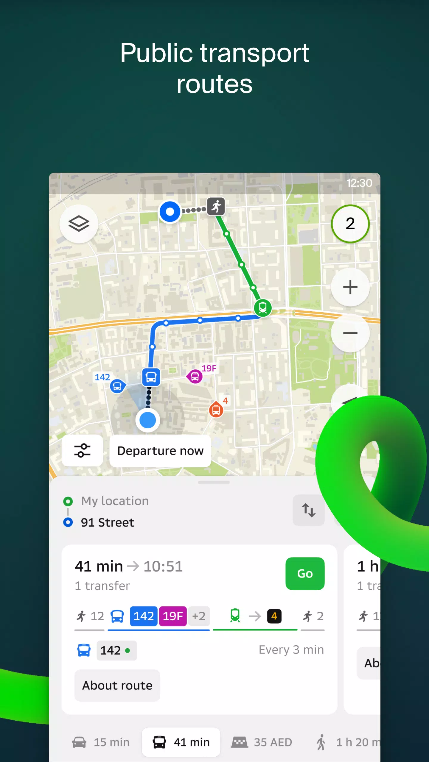
Transport and navigation
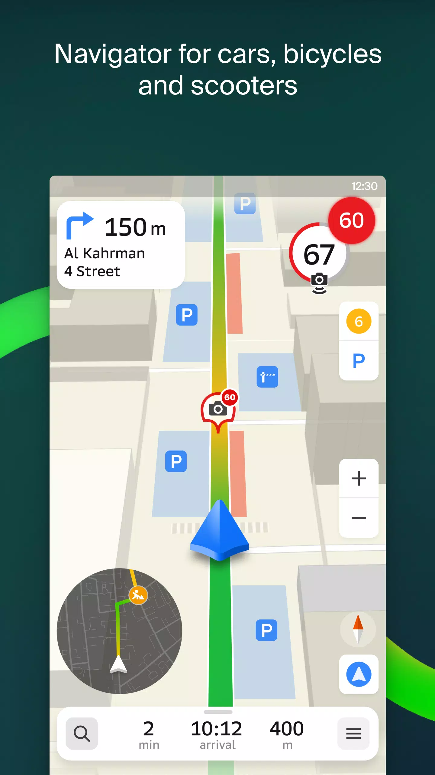
For drivers, 2GIS offers real-time navigation with voice instructions, taking into account traffic conditions and road closures. If you deviate from your route, 2GIS will recalculate to guide you back on track. For those using public transport, it will find the best routes using buses, metro, trains, cable cars, and river trams.
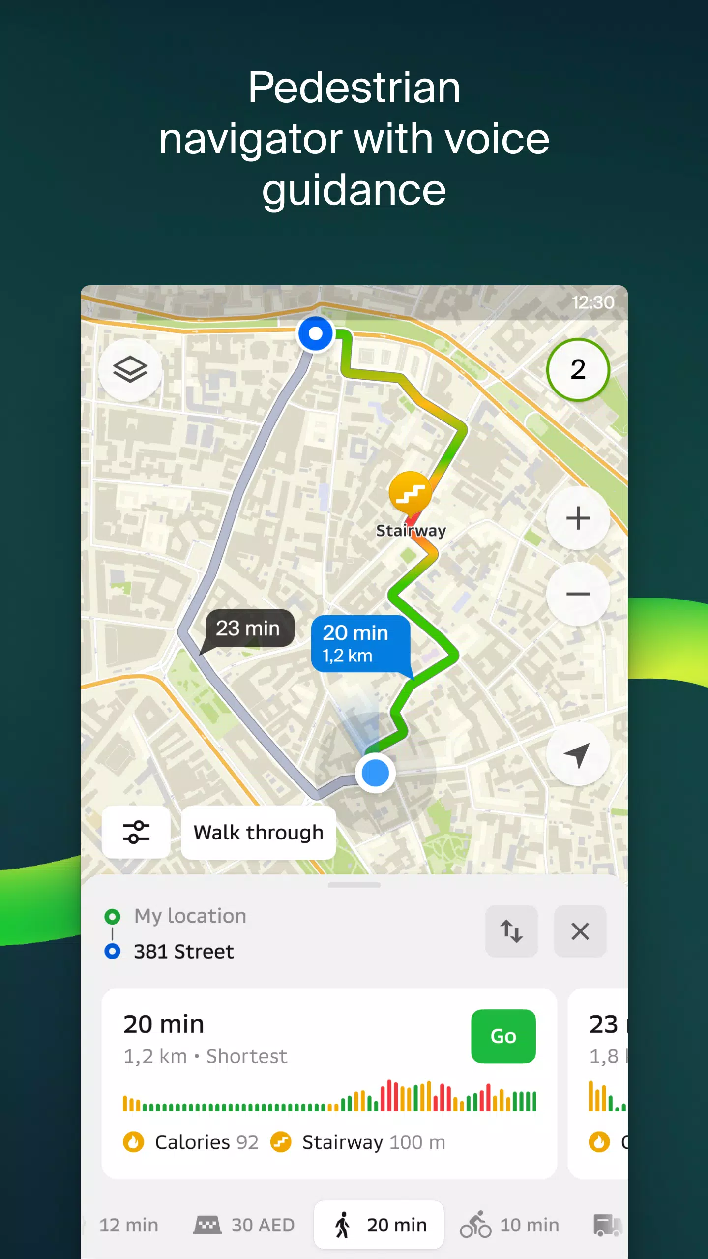
Walking routes
Our pedestrian navigation system helps you find the best path to walk. It operates in the background and provides voice guidance to make your journey easier.
Friends on the map
With 2GIS, you can now see the real-time location of your friends and family on the map! You control who you add as friends and who can see your location. Adjust your visibility settings as needed.
Building entrances
No more wandering around to find the right entrance. 2GIS knows the entry points for 2.5 million businesses. Whether you're using public transport or driving, we'll guide you directly to the door.
Plans of shopping centers
Navigate inside shopping centers with ease using 2GIS. Find everything from shops and cafes to ATMs and restrooms. Plan your visit in advance to save time.
2GIS beta Notifications companion app for smart watches on Wear OS
Enhance your navigation experience with our beta companion app for smart watches on Wear OS. View maps, get maneuver hints, and receive vibration alerts when approaching turns or bus stops. The companion app starts automatically when you begin navigation on your phone and is compatible with Wear OS 3.0 or later.
By using the beta version, you'll be among the first to receive updates and help shape the future of 2GIS, which will be used by millions. You don't need to uninstall the original version; the beta can run alongside it, allowing you to switch between them at any time.
Support: [email protected]
What's New in the Latest Version 6.44.1.559.3
Last updated on Oct 19, 2024
We're thrilled to introduce several new features and enhancements in our latest update:
- Enhanced Map Visualization: We now display wider, more realistic roads on the main map and during route searches.
- Chats for Friends: Stay connected with your friends directly within the app without leaving the map.
- Nearby Friend Notifications: Get notified when a friend is nearby (you can disable this in settings).
- Ski Lift Statuses: Just in time for the ski season, we've added real-time statuses of ski lifts on slopes.
- Walking Steps in Public Transport Routes: If your public transport journey includes walking, we now calculate that part in steps.
Screenshot

Reviews
Apps like 2GIS beta